Introduction to World Geography
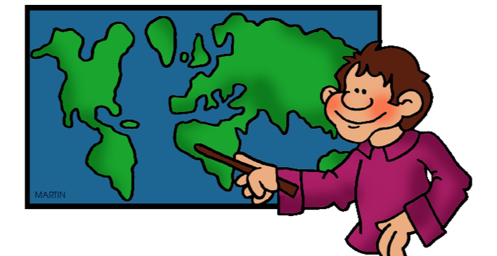
This course is designed to help students better understand the physical and cultural geography of the world, and the ways in which people interact with their environment. Students will study all parts of the world: Africa, Arctic/Antarctica, Asia, the Caribbean, Central America, Europe, the Middle East, North America, Oceania, and South America.
Weeks 1-2: How Geographers Look at the World
The study of geography can be organized around five themes: location, place, human/environment interaction, movement, and region. These five themes offer a structured way of thinking about the world and can be used to study all kinds of geographic issues at local, national, and global levels.
Student Learning Objectives:
Weeks 2-3: Absolute & Relative Location
Geographers study the location and distribution of almost everything on the surface of the earth. The absolute location of a place - its precise position on the globe - is an important part of their study. To determine absolute location, geographers use a network of imaginary lines around the earth. Lines of latitude and longitude cross one another, forming a pattern called a grid system, which makes it possible to find exact places on earth's surface.
Student Learning Objectives:
Weeks 4-5: World Climate Patterns
Climate affects the soil and natural vegetation of a region. Geographers often divide the earth into five major climate regions – tropical, dry, mid-latitude, high latitude, and highland. Because climates vary within these broad regions, geographers further divide the major regions into smaller ones.
Student Learning Objectives:
Weeks 6-7: United States Geography
Located in North America, the United States of America is bordered on the east by the Atlantic Ocean, on the west by the Pacific Ocean, on the north by Canada, and on the south by Mexico. The country is divided into six regions: the South, the mid-Atlantic, New England, the Midwest, the Southwest, and the West. There are 50 states and the District of Columbia, plus 16 territories (sub-national administrative divisions overseen by the U.S. government).
Student Learning Objectives:
Weeks 8-9: Global Footprint Fashion
Each day from the moment we wake up, we are contributing to our global carbon footprint - our full, climate change impact. While many everyday actions help reduce our carbon footprint, one not-so-obvious way is how to reduce the impact of our fashion choices on the world.
Student Learning Objectives:
Week 10: Finals Week
Extra Credit Opportunity: Create a detailed illustration of all 50 states in the USA, where each state flower represents and fills each state’s shape. Due by the end of the quarter (Friday, Oct. 27th)
Weeks 11-12: California Geography
California presents one - if not the - most diverse series of landforms in the United States. From the redwoods of the northwest to the Sierra Nevada mountains to Death Valley, California's landforms present geography students with a unique study in physical geography.
Student Learning Objectives:
Britannica Kids - California Physical Features
Week 13: Introduction to Oceans
In what ways are we all connected to the ocean? What moves from you to the ocean? What moves from the ocean to you?
Student Learning Objectives:
Week 14: Thanksgiving Break, School CLOSED
Weeks 15-16: Our Interconnected Ocean
"Over 70% of planet Earth is covered with water. Although there are labels that separate names of different regions, the Earth ultimately has just one large, interconnected ocean. The currents of this one big ocean carry people, animals, and debris around the globe. Tracking marine debris is one way to learn more about currents, and their impact on human activity." -National Geographic
Student Learning Objectives:
CNN: Woman tackles 'Great Garbage Patch'
Weeks 17-18: Central and South American Geography
"South America is a continent of extremes. It is home to the world's largest river, the Amazon, as well as the world's driest place, the Atacama Desert. South America, the fourth-largest continent, extends from the Gulf of Darién in the northwest to the archipelago of Tierra del Fuego in the south. South America's physical geography, environment and resources, and human geography can be considered separately." -National Geographic
Student Learning Outcomes:
Map of South America
Nat Geo South America Entry
Weeks 19-20: Winter Break, School CLOSED
Weeks 21-22: Quarter 2 Final Review & Exam
Quarter 2 Quizlet Study Set
Weeks 23-25: Africa
Sometimes nicknamed "The Mother Continent," Africa is the longest inhabited continent by humans on Earth. Humans, and our closest ancestors, have lived in Africa for over 5 million years. The second largest continent on the planet, Africa's physical geography, human geography, environment, and resources can all be considered separately. -National Geographic
Student Learning Outcomes:
Weeks 26 - 27: 2018 Winter Olympics
With over 90 countries participating in the 2018 Winter Olympics, this month is the perfect opportunity for students to explore geography while cheering for their favorite winter sports! "The XXIII Olympic Winter Games will be held for 17 days from 9 to 25 February 2018 in PyeongChang, Gangwon Province, the Republic of Korea. PyeongChang was selected as the host city of the 2018 Olympic Winter Games after receiving a majority vote at the 123rd IOC Session held on 6 July 2011 after three consecutive bids. The Olympic Winter Games will be held in Korea for the first time in 30 years after the Seoul Olympic Games in 1988. PyeongChang will be the stage for the Opening and Closing Ceremonies and most snow sports. Alpine speed events will take place in Jeongseon, and all ice sports will be competed in the coastal city of Gangneung." - PyeongChang 2018 Network
Weeks 28-29: Europe
Europe is the western peninsula of the giant "supercontinent" of Eurasia. Europe is divided from Asia by a series of watersheds, including the Ural River and the Caspian and Black Seas. Europe is the second-smallest continent. Europe is sometimes described as a peninsula of peninsulas...bordered by the Arctic Ocean to the north, the Atlantic Ocean to the west, and the Mediterranean, Black, and Caspian Seas to the south. Europe's physical geography, environment and resources, and human geography can be considered separately. -National Geographic
Student Learning Outcomes:
Europe: Countries Map Quiz Game
Week 30-31: Quarter 3 Finals Review and Exam Week
Week 32: Spring Break, School CLOSED
Weeks 33-34: The Danube River Basin
The Danube River is the second longest river in Europe after the Volga River in Russia. Its source lies in the Black Forest mountains of western Germany; it flows for approximately 2,850 kilometers to its mouth at the Black Sea. The Danube has approximately 300 tributaries. The river basin covers about 47,000 square kilometers...The Danube River has had a critical role in the history of Europe, as it has been used as a boundary, a trade route, a source of hydroelectric power, a source of residential water, and a major economic influence. -National Geographic
Student Learning Outcomes:
The Danube River Map
Weeks 35-36: Beyond Borders
Students will use maps to "think about how borders intersect physical and human geographical features, and how those intersections can lead to cooperation and/or conflict." After recently studying the Danube River conflict, this week students will "research four additional examples of physical geography and borders. They explore how mountains, oceans, and islands create physical barriers that affect the country borders in Europe." -National Geographic
Student Learning Outcomes:
Weeks 37-38: Cultural Borders
Culture is a shared set of meanings, such as values and beliefs and practices and ideas, which are lived through the material and symbolic practices of everyday life. Culture is entirely spatial. It can diffuse, contract, intensify, and expand, Often cultures will disappear entirely. Often people will fight to preserve their culture. One method of attempting to preserve a culture is to demarcate or solidify control over particular spaces or regions, At the global scale, this might mean gaining national control over a state apparatus. At the local level, this may mean establishing meeting spaces where only a certain culture congregates. -National Geographic
Student Learning Outcomes:
Week 39: Asia
"Asia makes up the eastern portion of the Eurasian supercontinent; Europe occupies the western portion. The border between the two continents is debated. However, most geographers define Asia’s western border as an indirect line that follows the Ural Mountains, the Caucasus Mountains, and the Caspian and Black Seas. Asia is bordered by the Arctic, Pacific, and Indian Oceans. Asia’s physical geography, environment and resources, and human geography can be considered separately." -National Geographic
Student Learning Outcomes:
Asia Physical Features
National Geographic: Asia - Physical Geography
Asia Map Quiz Games: Countries
Asia Map Quiz Games: Physical Features
Week 41: Final Exam Review
Quarter 4 Final Exam Review Guide
Extra Credit: Quarter 4 Geography Extra Credit
Week 42: Final Exams - Happy Summer Break!
The study of geography can be organized around five themes: location, place, human/environment interaction, movement, and region. These five themes offer a structured way of thinking about the world and can be used to study all kinds of geographic issues at local, national, and global levels.
Student Learning Objectives:
- Students will define: geography, absolute location, relative location, hemisphere, latitude, longitude
- Students will identify the five major themes of geography.
- Students will describe the geography of their community using the five geographic themes.
Weeks 2-3: Absolute & Relative Location
Geographers study the location and distribution of almost everything on the surface of the earth. The absolute location of a place - its precise position on the globe - is an important part of their study. To determine absolute location, geographers use a network of imaginary lines around the earth. Lines of latitude and longitude cross one another, forming a pattern called a grid system, which makes it possible to find exact places on earth's surface.
Student Learning Objectives:
- Students will be able to use a map to answer questions about longitude and latitude
- Students will identify cities based on their coordinate points
- Students will locate the Equator, Prime Meridian, hemispheres, and continents
Weeks 4-5: World Climate Patterns
Climate affects the soil and natural vegetation of a region. Geographers often divide the earth into five major climate regions – tropical, dry, mid-latitude, high latitude, and highland. Because climates vary within these broad regions, geographers further divide the major regions into smaller ones.
Student Learning Objectives:
- Students will understand how climates change over time.
- Students will identify the major global climate regions: tropical, dry, mid-latitude, high latitude, highland
- Students will explore ways that climate affects humans and their environment.
Weeks 6-7: United States Geography
Located in North America, the United States of America is bordered on the east by the Atlantic Ocean, on the west by the Pacific Ocean, on the north by Canada, and on the south by Mexico. The country is divided into six regions: the South, the mid-Atlantic, New England, the Midwest, the Southwest, and the West. There are 50 states and the District of Columbia, plus 16 territories (sub-national administrative divisions overseen by the U.S. government).
Student Learning Objectives:
- Students will be able to correctly identify all U.S. 50 states
- Students will explore the diverse landscapes of the United States
Weeks 8-9: Global Footprint Fashion
Each day from the moment we wake up, we are contributing to our global carbon footprint - our full, climate change impact. While many everyday actions help reduce our carbon footprint, one not-so-obvious way is how to reduce the impact of our fashion choices on the world.
Student Learning Objectives:
- Students will identify the sources of the clothing they wear everyday
- Students will map the impact of their clothing choices across the globe
- Students will identify ways to reduce their carbon footprint before and after they shop.
Week 10: Finals Week
Extra Credit Opportunity: Create a detailed illustration of all 50 states in the USA, where each state flower represents and fills each state’s shape. Due by the end of the quarter (Friday, Oct. 27th)
Weeks 11-12: California Geography
California presents one - if not the - most diverse series of landforms in the United States. From the redwoods of the northwest to the Sierra Nevada mountains to Death Valley, California's landforms present geography students with a unique study in physical geography.
Student Learning Objectives:
- Students will explore key events in California state history
- Students will identify and correctly map physical landforms of California
- Students will understand the diverse cultural geography of California
Britannica Kids - California Physical Features
Week 13: Introduction to Oceans
In what ways are we all connected to the ocean? What moves from you to the ocean? What moves from the ocean to you?
Student Learning Objectives:
- Students will explain how the ocean is the dominant physical feature on Earth
- Students will explore the significance of Marine Protected Areas
- Students will articulate why the ocean is so important
Week 14: Thanksgiving Break, School CLOSED
Weeks 15-16: Our Interconnected Ocean
"Over 70% of planet Earth is covered with water. Although there are labels that separate names of different regions, the Earth ultimately has just one large, interconnected ocean. The currents of this one big ocean carry people, animals, and debris around the globe. Tracking marine debris is one way to learn more about currents, and their impact on human activity." -National Geographic
Student Learning Objectives:
- Students will explain how Earth is covered by a single layer of connecting water
- Students will describe how the ocean has been categorized in the past and today
- Students will describe how currents move and what affects their movement
- Students will explain how ocean currents move marine debris and collect it
- Students will analyze case studies of major ocean pollution events
CNN: Woman tackles 'Great Garbage Patch'
Weeks 17-18: Central and South American Geography
"South America is a continent of extremes. It is home to the world's largest river, the Amazon, as well as the world's driest place, the Atacama Desert. South America, the fourth-largest continent, extends from the Gulf of Darién in the northwest to the archipelago of Tierra del Fuego in the south. South America's physical geography, environment and resources, and human geography can be considered separately." -National Geographic
Student Learning Outcomes:
- Students will correctly locate and label the seven Central American countries and thirteen South American countries
- Students will describe South American physical geography
- Students will explore the effects of human development on the Amazon rain forest
Map of South America
Nat Geo South America Entry
Weeks 19-20: Winter Break, School CLOSED
Weeks 21-22: Quarter 2 Final Review & Exam
Quarter 2 Quizlet Study Set
Weeks 23-25: Africa
Sometimes nicknamed "The Mother Continent," Africa is the longest inhabited continent by humans on Earth. Humans, and our closest ancestors, have lived in Africa for over 5 million years. The second largest continent on the planet, Africa's physical geography, human geography, environment, and resources can all be considered separately. -National Geographic
Student Learning Outcomes:
- Students will correctly identify and locate the countries of Africa on a map
- Students will research individual African countries and share their findings with the class
- Students will explore who the Lost Boys of the Sudan are and their experiences fleeing Sudan
- Students will understand the exploitation of natural resources in Africa and the subsequent effects on local communities
Weeks 26 - 27: 2018 Winter Olympics
With over 90 countries participating in the 2018 Winter Olympics, this month is the perfect opportunity for students to explore geography while cheering for their favorite winter sports! "The XXIII Olympic Winter Games will be held for 17 days from 9 to 25 February 2018 in PyeongChang, Gangwon Province, the Republic of Korea. PyeongChang was selected as the host city of the 2018 Olympic Winter Games after receiving a majority vote at the 123rd IOC Session held on 6 July 2011 after three consecutive bids. The Olympic Winter Games will be held in Korea for the first time in 30 years after the Seoul Olympic Games in 1988. PyeongChang will be the stage for the Opening and Closing Ceremonies and most snow sports. Alpine speed events will take place in Jeongseon, and all ice sports will be competed in the coastal city of Gangneung." - PyeongChang 2018 Network
- Students will understand the intention and design behind the Olympic rings
- Students will track individual countries' success during the Olympics and total medal count
- Students will explore the physical and human geography of South Korea
Weeks 28-29: Europe
Europe is the western peninsula of the giant "supercontinent" of Eurasia. Europe is divided from Asia by a series of watersheds, including the Ural River and the Caspian and Black Seas. Europe is the second-smallest continent. Europe is sometimes described as a peninsula of peninsulas...bordered by the Arctic Ocean to the north, the Atlantic Ocean to the west, and the Mediterranean, Black, and Caspian Seas to the south. Europe's physical geography, environment and resources, and human geography can be considered separately. -National Geographic
Student Learning Outcomes:
- Students will identify characteristics of the major physical regions of Europe
- Students will examine the flora and fauna of Europe
Europe: Countries Map Quiz Game
Week 30-31: Quarter 3 Finals Review and Exam Week
Week 32: Spring Break, School CLOSED
Weeks 33-34: The Danube River Basin
The Danube River is the second longest river in Europe after the Volga River in Russia. Its source lies in the Black Forest mountains of western Germany; it flows for approximately 2,850 kilometers to its mouth at the Black Sea. The Danube has approximately 300 tributaries. The river basin covers about 47,000 square kilometers...The Danube River has had a critical role in the history of Europe, as it has been used as a boundary, a trade route, a source of hydroelectric power, a source of residential water, and a major economic influence. -National Geographic
Student Learning Outcomes:
- Students will analyze environmental, political, and other issues that surround the building and maintenance of dams on shared rivers
- Students will explore how country borders can add complexity to decisions surrounding dams and other uses of natural resources
- Students will describe a case study of a dam and explain its impacts on several countries along the Danube River
- Students will understand how human actions modify the physical environment
- Students will examine how the forces of cooperation and conflict among people influence the division and control of Earth's surface
The Danube River Map
Weeks 35-36: Beyond Borders
Students will use maps to "think about how borders intersect physical and human geographical features, and how those intersections can lead to cooperation and/or conflict." After recently studying the Danube River conflict, this week students will "research four additional examples of physical geography and borders. They explore how mountains, oceans, and islands create physical barriers that affect the country borders in Europe." -National Geographic
Student Learning Outcomes:
- Students will research examples of physical features in Europe that intersect with country borders in interesting ways
- Students will understand changes that occur in the meaning, use, distribution, and importance of resources
- Students will work in cooperative learning groups to research case studies of countries' disputes over physical geography
- The North Sea
- Scandinavia
- Strait of Gibraltar and Rock of Gibraltar
- The Netherlands and Reclamation & Flood Control
Weeks 37-38: Cultural Borders
Culture is a shared set of meanings, such as values and beliefs and practices and ideas, which are lived through the material and symbolic practices of everyday life. Culture is entirely spatial. It can diffuse, contract, intensify, and expand, Often cultures will disappear entirely. Often people will fight to preserve their culture. One method of attempting to preserve a culture is to demarcate or solidify control over particular spaces or regions, At the global scale, this might mean gaining national control over a state apparatus. At the local level, this may mean establishing meeting spaces where only a certain culture congregates. -National Geographic
Student Learning Outcomes:
- Students will research examples of a cultural feature that has impacted a country border
- Students will consider how cultural features can affect country borders
- Students will develop generalizations about the impacts of cultural features on borders
- Students will explore four case studies of cultural borders in Europe: the Roma, the Basque, Moldova, and Cyprus
- NYT Roma Culture 101
- NYT Theatre Union Decides That 'Gypsy' Must Go
- Basque Country Video Link
- Meet the People of Transnistria, a Stuck-in-Time Soviet Country that Doesn't Exist
- Ghost City
Week 39: Asia
"Asia makes up the eastern portion of the Eurasian supercontinent; Europe occupies the western portion. The border between the two continents is debated. However, most geographers define Asia’s western border as an indirect line that follows the Ural Mountains, the Caucasus Mountains, and the Caspian and Black Seas. Asia is bordered by the Arctic, Pacific, and Indian Oceans. Asia’s physical geography, environment and resources, and human geography can be considered separately." -National Geographic
Student Learning Outcomes:
- Students will identify the physical features of Asia
Asia Physical Features
National Geographic: Asia - Physical Geography
Asia Map Quiz Games: Countries
Asia Map Quiz Games: Physical Features
Week 41: Final Exam Review
Quarter 4 Final Exam Review Guide
Extra Credit: Quarter 4 Geography Extra Credit
Week 42: Final Exams - Happy Summer Break!
